Day 3:
8-9 miles
Huckleberry Springs to Granite Meadow
Thursday morning we say goodbye to our lovely Huckleberry Springs and prepare to head upriver again. Ken remembers that Granite Creek is somewhere up ahead, so we make that our goal.
It has rained during the night.
Actually, it has rained, thundered, and flashed lightening during the night!
Our tents were dry and cozy, but the lightening…wow!
The light flashes penetrated the tent, penetrated closed eyelids…I could even see the flashes when I pulled my head inside my mummy bag hood and had a layer of sleeping bag over my face!
This morning the rain has stopped but the bushes are wet.
We explored a bit of the trail yesterday afternoon, so we know there are some brushy places to muscle through.
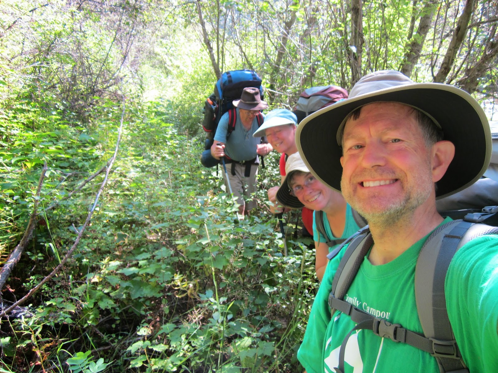
In addition to the wet brush, there are several dead trees across the trail. Most of them can be navigated, but one of them is just too big. Dorothy and I crawl beneath and drag our packs behind us. The boys are more dignified, and climb off the trail a few feet to navigate a lower place on the log.
For most of the morning, though, the most difficult part of this section of trail is the brush. It can be tall grass, or thimble berries, or huckleberries, or willows, or ferns, or any combination of the above. It can be knee high, waist high, shoulder high, or above our heads. It can be hanging slightly over the trail or (almost) completely obliterating the trail. Trails like this make me so grateful for trails that are well maintained!
Even though I am hiking with rain pants to repel the water clinging to the bushes, even though I have new goretex boots, my clothing eventually succumbs to the inexorable forces of water + gravity.
My feet are soaked. My toes are sloshing inside the socks. Every step brings the sensation of
squelch, squelch, squelch.
When we stop for a break, I wring at least 1/4 cup of water out of each sock.
Sigh. My rain pants are wonderful, but they are 1" too short. Instead of riding over the top of my boots, they are
funneling water from the wet brush along the trail down into my boots.
After 3.5 hours of slogging along, we stop for lunch at Wind Rock, where we find the foundation of a structure…perhaps an old mining cabin? We know there are some in the area.
The rest of the afternoon goes more quickly. There are still a few brushy places, but the trail clears, diversifies, is much more interesting.
And although we don't know it yet, there are a couple of wonderful surprises waiting for us around the corner!
First up…SALMON! The rangers in Ukiah had told us we might see Chinook salmon heading to their spawning beds. There are at least 100 salmon swimming in this deep pool at one high overlook.
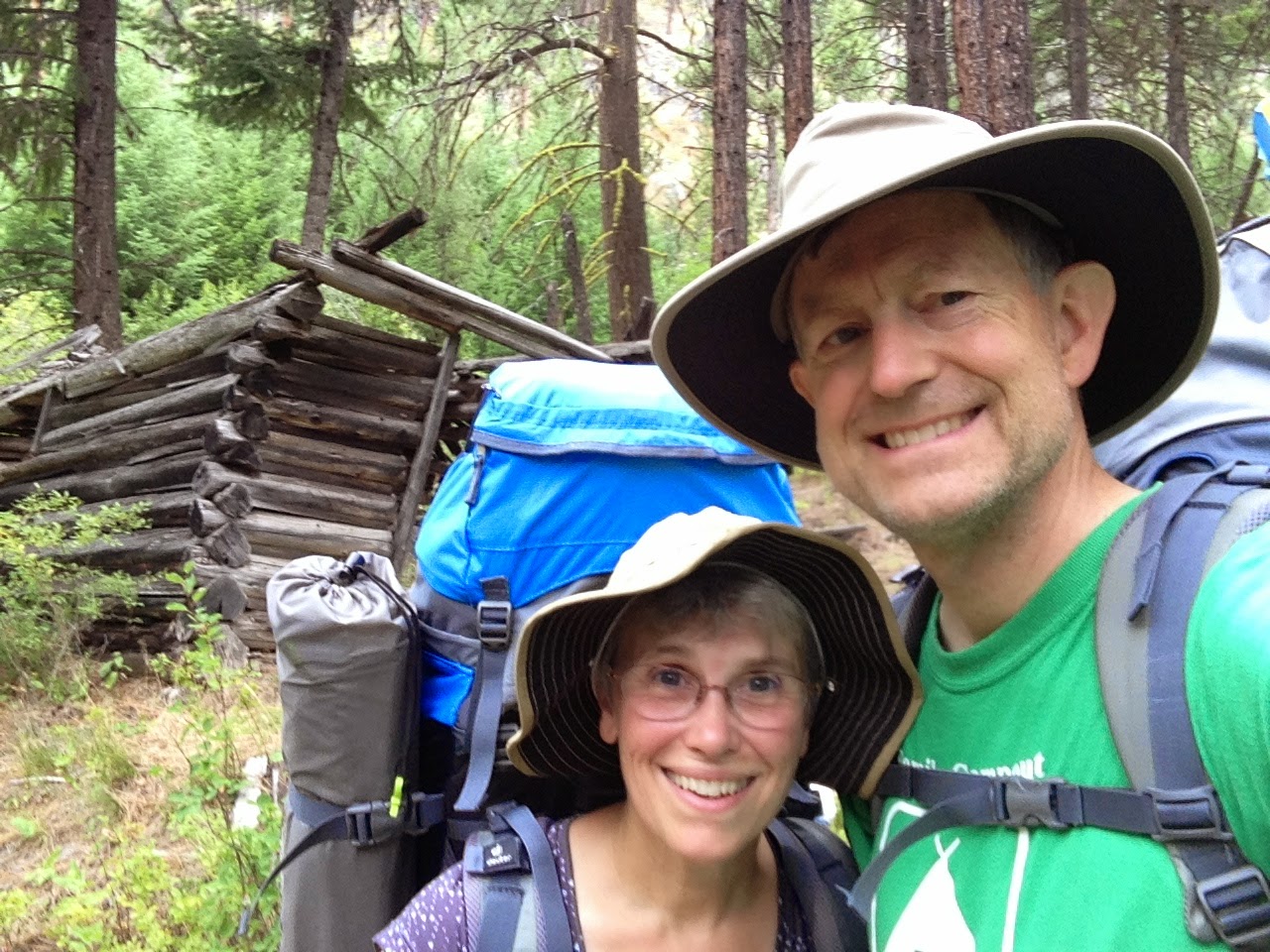
Not long after spotting the salmon, we round a corner in the trail and come upon an abandoned log cabin.
I can't soak up enough of the details. It reminds me so much of Lydia's cabin in one of the books I teach,
The Jump-Off Creek by Oregon author Molly Gloss.
The setting is perfect - we are hiking in the Blue Mountains of Oregon, the same setting as the book. The cabin matches the dimensions of Lydia's cabin. Even though I know Lydia and her cabin are fictional, I feel as though I have found the home of an old friend.
By this time, we are pooped. Surely any campsite will do. We have been hiking all day, and my feet are still wet and beginning to blister.
We have made 13 water crossings across streams that feed into the North Fork of the John Day.
We have encountered numerous bear scat (poop) - so many that I have lost count.
When we take a break at a small campsite, I enthusiastically point out the two log benches - such nice amenities! When will we find another campsite this lovely? I am so tired…
The group decides it is not a feasible site. Too much bear scat along the trail. We push on, hoping to come to Granite Creek.
Finally, about 30 minutes later, we come to the largest stream crossing yet. Granite Creek!
The North Fork of the John Day River bends to the left, and Granite Creek comes in from the right.
Oh, look at that lovely meadow! Maybe we can camp there.
Will there be a bridge???
The river is much smaller now than it was when we began hiking. I am so tired. I want to go camp in that meadow, and if I have to I will wade across the river.
But no…there is a bridge!!
A lovely strong beautiful bridge.
A bridge that leads across the river into a lovely established campsite.
Stay tuned…my next post will be about our wonderful base camp where we camped for 4 nights at Granite Meadow.